Hi there. As I was having such fun with St Francis pictures before blogger uncharitably stopped uploading them the other day, and I gather from the comments that you enjoyed them too, I decided to have a look at the whole area, and show you the lay of the land, so to speak!
 So first, a general overview. The area locally referred to as St Francis comprises 3 main sections and a number of lesser areas within those. As you can see, courtesy of Google Earth, the Greater St Francis area actually consists of 2 points (Shark Point and Seal Point, which has the lighthouse) and 2 bays (St Francis Bay and Cape St Francis).
Travelling from Port Elizabeth in the East, you first come across St Francis Bay.  This is the area I have described before, where the farmer who owned the land, and first had the brainwave to establish the village, decreed that all houses must be painted white and have thatched roofs, or slate or black tiles. He also set maximum height restrictions to avoid ugly blocks of apartments, and to prevent people hogging the views. This area includes the village, which is mostly built around the shopping centre and golf course, and the canals, which boast some incredible mansions.
  this is an aerial shot taken about 6 years ago,
 and here it is now, as per Google Earth Moving down towards the first point, you come to an area called Santareme, where the houses all have to have red tiled spanishy looking rooves, and "sand" coloured walls, which has been pretty widely interpreted!
 This is the area I have described before, where the farmer who owned the land, and first had the brainwave to establish the village, decreed that all houses must be painted white and have thatched roofs, or slate or black tiles. He also set maximum height restrictions to avoid ugly blocks of apartments, and to prevent people hogging the views. This area includes the village, which is mostly built around the shopping centre and golf course, and the canals, which boast some incredible mansions.
  this is an aerial shot taken about 6 years ago,
 and here it is now, as per Google Earth Moving down towards the first point, you come to an area called Santareme, where the houses all have to have red tiled spanishy looking rooves, and "sand" coloured walls, which has been pretty widely interpreted!
  Then you come to Port Saint Francis. This incorporates the Hotel, a shopping complex, and lots of Meditteranean style holiday cottages, and luxury complexes along the breakwater,
  as well as a private beach, the working harbour and yacht basin, and a fish processing plant.
 The Port was a project that took a lot of vision to establish. Luckily, when I was spending a lot of time decorating in the area, which would be about 8 or 9 years ago, we took a couple of photos to show how the harbour was literally carved out of a section of coastline.
 A basin was dug, and all the rock removed was thrown into the sea to form the foundations for what is now the breakwater and harbour wall. In the basin, humungous concrete forms were made.
 They were originally developed in South Africa, and are called "dolosse" after the little clay oxen made by rural African children in their villages. They are now used in breakwaters worldwide. (To give you an idea of how huge they are, the seagulls are standing on the end of one of those that protrude above the harbour wall.)
  Once the basin was done, and the breakwater complete, the opening at the mouth of the harbour wall was blasted open to let the ocean in. Then the development of the housing and retail areas began.
  While Ian was doing his commercial pilots licence, he took us for a flip over St Francis, I think it was 2001, and we took these aerial photos.
  As you can see, in the 5 years since then, there has been enormous development in the whole area. This is how it looks now, on Google Earth.
I mentioned the other day that we added a few homely touches to the suite at the hotel.
 It is the one at the bottom right, behind the white boat.
Here is the main room before....


 ... we hung a painting above the sleeper couch,
  on the side wall as you enter, beside the beds, we hung a painting I did of the yacht basin in Port Elizabeth (yes I know, all these yacht pix are a bit of a cliche but I'm sure the tourists will love it!)
 above a funky table I designed, which has sandblasted wood for texture, and pebbles under glass on top.
 The next room was very bleak
 but we added couch and chair, and leather ottoman, and a painting and rug. It has made it into a really user-friendly space for relaxing and enjoying the view of the harbour. We still need to fit the wooden venetian blinds for a bit of shade and privacy in there.
 Here, I am recovering from the exertions of hanging pictures, and downloading more pix!
 The Kitchenette was a little impractical,
  So we added extra shelves. It is such a lovely relaxing place to spend time, we can't wait for another gap in our schedules so we can go back.
 Moving on along the coast, 5km beyond St Francis bay, you have Cape St Francis. I always feel like I have died and gone to heaven when I get there, especially when we are on the rocks watching the sea, and the worse the weather, the nicer it is!
 The point closest to the Port is Shark point, which leads into a gently curving bay, with a wonderful beach. The sand is pristine white,
 the wind can be hectic, this day we thought the skin would be sandblasted off our legs...
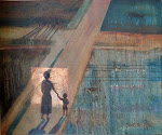
 but it produces such interesting textures,
  and this one, which I call "el Torro" was one of those wonderful things that happens after a storm, with a drifting log swallowed by sand.
As we continue round, we get to Seal point, a great surf spot.
.jpg) Then on the point itself is the lighthouse which i have already rabbitted on about so often that I will spare you more comment now!
Then on the point itself is the lighthouse which i have already rabbitted on about so often that I will spare you more comment now! The coast completely changes on the other side of the point, and is not called "the wild side" for nothing! There is a trecherous reef which goes out 10 km into the sea, and has claimed quite a few ships over the years
 like this wreck, which has become one with the rocks, and is only visible at very low tides.
 It is here where the waves really pound on the rocks, this is my favourite of all the wave photos I've taken so far.
Further along the coast towards Plettenburg Bay, the rocks get even wilder, this place is called "huisklip, and has a huge cave that the waves rush right through, but that is another story for another day!

This has taken longer than I expected, so all the other stuff i wanted to tell you, as well as visits and replies to comments will have to wait till tomorrow, I did a whole bunch of ATCs which i will show you.
Cheers till then!


7 comments:
FANTASTIC photos. Everyone is interesting. It looks like a beautiful place, a land of perpetual sunshine.
Thank you for sharing your corner of the world ion this dull winter (for me) day..
Hugs..xo
LOVE your photos, Suzi-k! Look forward to seeing more.
Shirley in New Zealand
I agree - the photographs are great, and so are the fantastically blue yacht paintings.
Suzi - e-mail me and I'll give you details about Hugh's painting.
Lindsay@theworkhouse.net
I agree with Mum, these photos are FANTASTIC. I love them all! YOu have brightened up my day, my world!
Thanks!
A wonderful guided tour! Love the sand and the waves.
You have the most amazing photos! And you always tell such interesting stories about everything. I always feel as if I've had a mini-vacation when I visit your blog!
Hi ..Blue the Spa Girl is my daughter..xx
Post a Comment